Moto Tour to Bandung

Hi again guys, I apologize because I haven’t got any chances to write my next journey. But now, I’m back . . Enjoy the stories!

maxresdefault


Bandung City

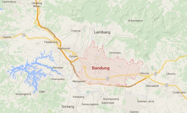
also known as Flower City is the capital city of West Java Province. It located between the Purwakarta Town and Garut Town in West side of Java Island, Republic of Indonesia. Did you know? Bandung is a beautiful place to live and based on a survey, Bandung Citizens is the most happiest people in Indonesia!

                        Five months ago I visited Bandung with my brother Aldino Friga by Motorcycle. We took 10 hours from Yogyakarta to get there in single moto tour. This time our travel weren’t easy, We have to face the heavy-rain and windy weather in the middle of our tour. While in the other side, the road condition wasn’t good enough for us and there were so many Budiman Busses driven reckless in very high speed which could make us killed. Imagine this . . you are riding your motorcyle in right line with normal speed around 80-90 KM/H but suddenly, from the curve road a Great Bus turns up opposites you and it is using your way! So of course we have to step a side and clear the road for them to stay alive. Can you believe that?? But luckily, We both could survive from those challenges with carefully, Yeah We made it . . We both arrive in the Bandung City.

Owner Jelajah

                          Finally Bandung, Our first destination is Situpatenggang Lake in South Bandung. When we reach in the middle of the city, we were getting stuck on the road by the citizen crowd. And from this experience, I knew that Bandung have a big problem with trafic jam. May be the Mayor, Mr. Ridwan Kamil should take some actions and policy to end this very stressing trafic jam. By the way, after all those set of problems . . We both continued our trip to Situpatenggang Lake. We were going and keep going far away from the city to the south. May be it needs more than three hours to get there. Then, we saw the nice of Bandung !!


20151114_141821_Richtone(HDR)

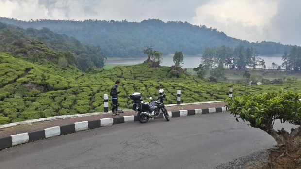
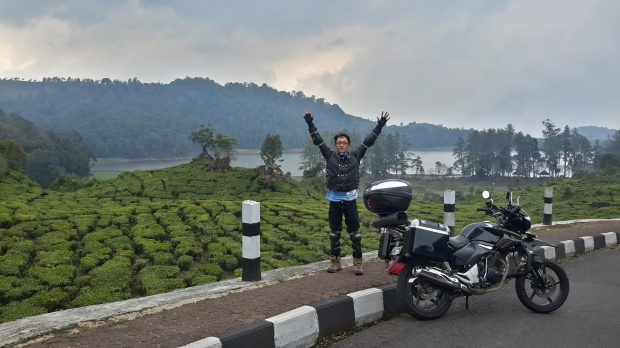
Me near The Situpatenggang Lake Surrounded by Tea Garden 


20151114_165444

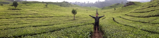
Breath the Fresh Air


20151114_170632_Richtone(HDR)

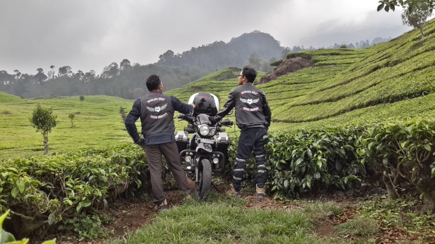
SERGAP Touring Community

                                       It was amazing! All of our struggle most likely paid because of this beautiful view and also the totally fresh air. We felt so satisfied until we could enjoy every elements of the place. Even the wind sound, cold dew and the silent of mother nature.  We were very gratefull to God for all those moments. It’s more than just a lake and garden, because we could get more close to nature . . From this part,  I’m pretty sure that Bandung City have other beautiful place whiches spread in various location. So, let see all the place we’ve visited in Bandung!

20151114_183520

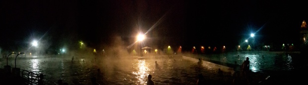
Hot Bathing Pool Place near Situpatenggang Lake
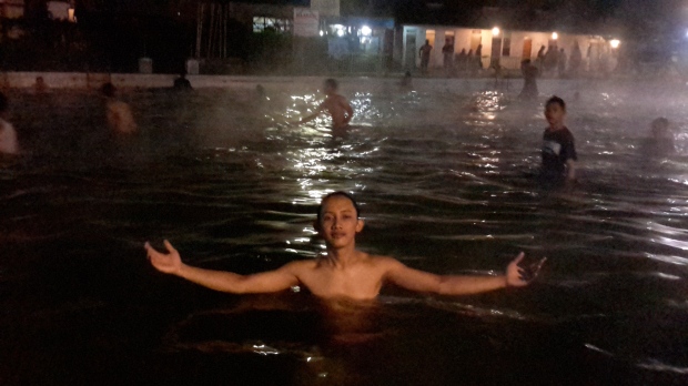
20151114_184046

Enjoy the Hot Water

20151115_132005

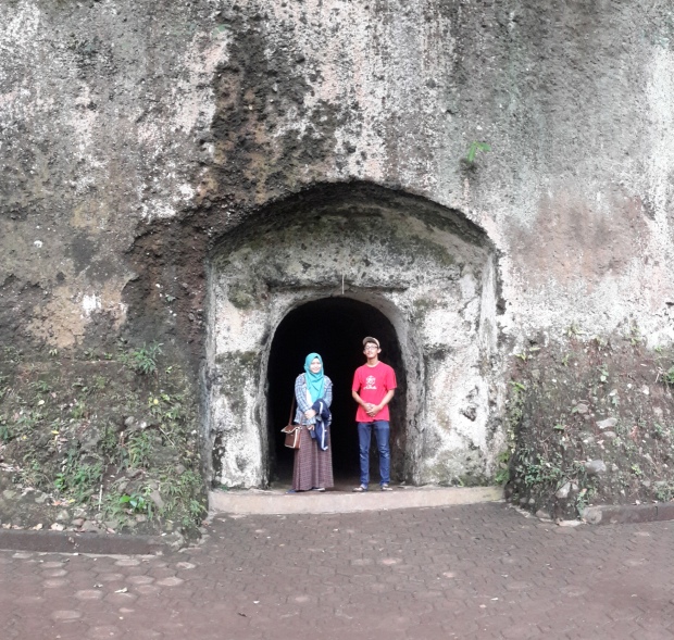
Japanese Cave in Tahura with my Friend, Shelvy

20151115_134046

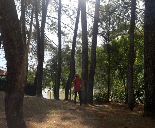
Tahura Bandung, The Pine Trees

20151114152658

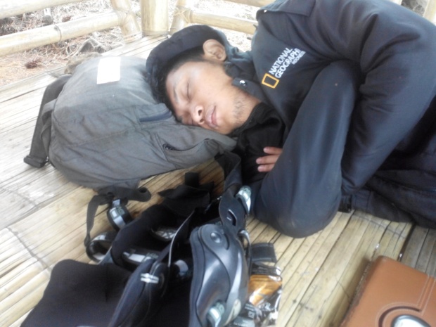
My Brother Fall as Sleep

20151115100214

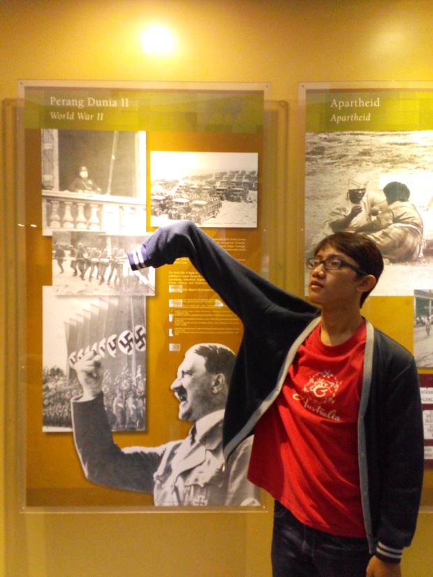
Fail Hitler in Museum of Asian-African


20151115095406

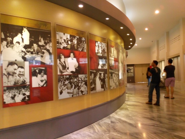
History of Asian-African Confrence
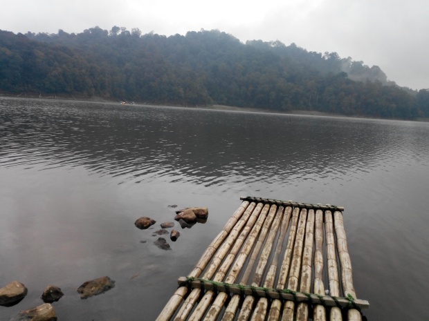
20151114161157

Situpatenggang Lake

20151114_142332_Richtone(HDR)

Good Times, Enjoy Your Life & Be Gratefull to God


:We felt so satisfied until we could enjoy every elements of the place. Even the wind sound, cold dew and the silent of mother nature.  We were very gratefull to God for all those moments.”

The Museum of Asian-African Conference is one of the museum located in the city of Bandung. Located on Number 65 Jl.Asia Africa . This museum is the memorabilia of the Asian-African Conference . The museum has a very close relationship with the Gedung Merdeka. Overall, Gedung Merdeka has two main buildings, which first called Gedung Merdeka as the main venue, while residing beside the Merdeka Building is the Museum of the Asian African Conference as a memorabilia of the Asian-African Conference . The background of the construction of this museum was because the desire of the leaders of the nations in Asia and Africa to know about Gedung Merdeka and surrounding places Asian-African Conference took place.


To be continued because I forgot where did I put the photos . . .

Mt. Merbabu Summit 3142 MASL

Mountaineers are Brothers

Mountaineers are Brothers, Location : Savana 2 in Mt. Merbabu

It was my second time went to Mt. Merbabu, the first time my group were contains 30 persons from my Electrical Engineering major in Islamic University of INDONESIA located on Sleman, Special District of Yogyakarta Province.

The first trip was on rainy season which made it so heavy, there were a stormy rain appeared when we reached the Savana 3 located near the Mt. Merbabu Peak. We weren’t able to summit the peak because of that worst weather.

Stormy Rain riuned the Trip

Stormy Rain ruined the Trip

We stop to hike the Peak because it was too cold & wet

We stop to hike the Peak because it was too cold & wet

But this time, My group only contains 5 person. Each of us have a main task to make sure that our Hiking is good and safe. It were sunny day so I wished that we could summit the Mt. Merbabu Peak.

We started to hike Mt.Merbabu at 14.00 o’clock (afternoon) on May 16th, 2015. We went up from the Basecamp in Selo, Boyolali Regency – Central Java. There will be Seven hours track to pass until the 3rd Station near the Peak.

Welcoming Gate to Mt. Merbabu

Welcoming Gate to Mt. Merbabu

Good Trip, what a SUnny day Yeah !!

Good Trip, what a Sunny day  Yeah !!

It was a quite long trip with unhealthy body to defeat, exhausted spirit and hungry stomach. Luckily my friends brought many bread to fill our energy. My group passed a beautiful Savana field in Station 2 until Station 3, the scenery were amazing and the Mountaineer we met were very kind too. All of them smiled to us and cheered up on us for energizing our spirit!

Savana Field near the Mt. Merbabu Peak

Savana Field near the Mt. Merbabu Peak

We reached the 3rd Station at 21.00 o’clock (Night), we stop for a while to build a tent. We were taking a rest, ate some noodles with chips and after that we slept on 23.00 o’clock. We were sleeping for 3 hours until 02.00 o’clock (Late Night). Then we woke up and prepared all the stuff to go the Mt. Merbabu Peak.

Budi and I have some jokes

Budi and I have some jokes

Take a selfie for a while on my 70 Litres Earth Explorer series from NG Carrier Bag

Take a selfie for a while on my 70 Litres Earth Explorer series from NG Carrier Bag

The 3rd Station called The 3rd Savana

The 3rd Station called The 3rd Savana in afternoon

It needed almost 1 hour trip to hike from the 3rd Savana to Mt. Merbabu Peak. The track wasn’t easy as I thought, it was sandy & steep enough to slip you down. We have to be more focus with the track here, it different with previous track

2015516064037

Go Down after sunrise, Watch Your Steps if you want to go to Kentheng Songo Peak

Make sure your Mountain Gear shoelace tight !

Make sure your Mountain Gear shoelace tight !

We struggled just for a Sunrise Moment on the Peak, we wanted to catch the awesomeness of Mt. Merbabu Sunrise that very beautiful liked we heard from all the Mountaineers.

The Peak named Kentheng Songo because there was a group of stone called “Watu Kentheng Songo” or “Nine Kentheng Stones” in English that already there since Mt. Merbabu shaped by the Earth. But did you know the truth about the stone? There only four stone on the Kentheng Songo Peak, so why was it called “The Nine Kentheng Stone” ??

The 4 Stones of Kentheng Songo which have 9 holes

The 4 Stones of Kentheng Songo which have 9 holes

If we notice those four stones, each of them have a small cauldron hole on the Top. But the villagers near the Mt. Merbabu said that there were always 9 Holes on those stones. How it could be liked that??

The answer was the Mt. Merbabu Legend, it told us that only with a Spiritual Inner Eyes who could see the stones have a Nine holes, so there were 5 magic stone holes that you couldn’t see.

Deny Yusuf and I Wait for Sunrise

Deny Yusuf and I Wait for Sunrise on Kentheng Songo Peak

And with that togetherness, we passed all of it and reached the Mt. Merbabu Peak!

Now . .Today, August 17th 2015 is Indonesian Independence day. I want to say . .

Happy 70 years Independence day Indonesian people . . MERDEKA !!!

Stay Love Indonesia, the Land of Paradises from Banda Aceh to Papua!!
Be Strong, Be Prepared . . Indonesia’s Future is in our Hand. The Young Generation!!

Merah Putih flag of INDONESIA

Flying the Flag of INDONESIA at Sunrise moment

Red is Brave, White is Pure. Love Indonesia!

Red is Brave, White is Pure. Love Indonesia!

Red & White flag I raised over the clouds on the Mt. Merbabu Peak

Red & White flag I raised over the clouds on the Mt. Merbabu Peak

2015516054648

Skyline

2015516053633

The Savana View in Mt. Merbabu Track

Selfie over the clouds before sunrises

Selfie over the clouds before sunrises

Together we made it brothers

Together we made it brothers

Seeing the Beauticul View

Seeing the Beauticul View

Sunrise shined my face, what a lovely warm lights in this Cold Mountain

Sunrise shined my face, what a lovely warm lights in this Cold Mountain

2015516061055

Beautiful Mt. Merapi in front of us and also Edelelwys Flowers FIeld with Savana Track in Mt. Merbabu

Over the Clouds

Moon over Mt. Sindoro & Mt. Sumbing Clouds in early Morning

Merapi Volcano Summit 2.913 MASL

Merapi Volcano view from near

Merapi Volcano view from near

Mount Merapi or well known as Gunung Merapi is an active stratovolcano located on the Province border between Central Java and Yogyakarta, INDONESIA. This Mount is the most active volcano in Indonesia and has erupted regularly since 1548. Thousands of people live on a Village flanks near the volcano with high 1,700 metres (5,600 ft) above sea level.

Mount Merapi in the Morning

Mount Merapi in the Morning

Merapi Smoke’s can be seen emerging from the mountaintop at least 300 days a year, and several eruptions have caused fatalities. Pyroclastic flow from a large explosion killed 27 people on 22 November 1994, mostly in the town of Muntilan, west of the volcano. Another large eruption occurred in 2006 & 2010, shortly before the Yogyakarta Earthquake which centered in Bantul Regency. People living within a 20 km (12 mill) zone were told to evacuate. Officials said about 500 volcanic earthquakes had been recorded on the mountain over the weekend of 23–24 October, and that the magma had risen to about 1 kilometre (3,300 ft) below the surface due to the seismic activity. Now, the volcano is now 2913 metres high,55 metres lower than before the 2010 eruptions.

source : https://en.wikipedia.org/wiki/Mount_Merapi

Summit Warning for all the Mountaineer

Summit Warning for all the Mountaineer

Our group were contain 6 person, we start to hike Mt.Merapi in December 5th 2014 from Selo Basecamp in Boyolali, Central Java. The track we passed to defeat this mountain were so uphill, it needed total 5 Hours to reach Pos Pasar Bubrah or “The Devil Market station” in English. Why it called “The Devil Market”? Because the Villagers believe that all kind  of Demon, Devils and Jinn lived in that area. Once, a shaman saw how crowd they communicated to each other, it just like a Market. So they called it “The Devil Market”. Any way in this area, there were a sign stood beside a tomb. A warning which recommended anyone to stop whenever they want to reach the Mt. Merapi Peak because its too risky and the volcano were Hazardous.

Pos Pasar Bubrah or The Devil Market station

I’m standing in Pos Pasar Bubrah or The Devil Market station

But who cares, I could tell you that this moment You were fighting with yourself. Go down then all you struggle were useless, Go up then you would be closer to the death. So I prefer to keep moving with my friends. We tried to defeat our fear, we sticked together, and we all believed that we will find ourself reached the Mt. Merapi Peak alive!

Summit to the Mt. Merapi Peak on 2913 Meter Above Sea Level

Summit to the Mt. Merapi Peak on 2913 Meter Above Sea Level

God!! It’s harder than I ever thought to reach the peak. the cliff was so steep than it seems, there were rocks fell toward us from the other hiker footstep, the cold weather made you hard to breath,  for every step you took would be sink by sand, and on the top . . there were deadly poisonous smokes from inside the Volcano waiting for you.

“Go down then all you struggle were useless, Go up then you would be closer to death. .”

20141206111401

DSC_0052

In this summit track, we have to be more patience than before, more focus to choose the way we step. Just one wrong way we got, there will be a risky cliff waiting for us fell. And each wrong step you made, some serious injuries you may caused. So we should be careful to look after each other here. Don’t make any mistake, it will be your last breathe in this beautiful mountain

“Don’t make any mistake, it will be your last breathe . .”

After one hour passed the Heavy & Rocky track to Mt. Merapi Peak, finally me made it. We reach the Top of this Hazardous Volcano. But unluckily there were foggy that day because of rain that happened when we still in Pos Pasar Bubrah, so we have to wait at least one hour to see the beautiful view

20141206064822

View of Mount Merbabu in front of us

20141206075856

Above the Clouds

IMG_0052

Foggy Peak on the Top of Mt. Merapi

20141206130132

I’m in front of the Hot Cauldron

20141206123730

Groupie with Phone Camera Fish Eye

We spent two hours enjoyed the Top of Merapi Mount, we felt very satisfied and so happy in this journey. But suddenly, we were speechless. We heard crasher sounds repeatedly, just like the sound of big rocks fell to a deep ravine. We shocked and worried if it came from inside the Mt. Merapi Cauldron, it could be some moving magma or deadly smokes appear to us. We gonna die, we scared that Mt. Merapi will had an eruption. Then we pray for ourself and ask to Allah for keeping all the danger far away from us. . And luckily, after we focused on that sound. We knew that the sound didn’t come from the Mt. Merapi Cauldron, but it came from the cloudy clouds above us. We realized that it would be rain, so we went down to our camp looking for a shelter.

20141206092216 DSC_0056 IMG_0012

DSC_0190

From Left to Right : Prisma Sanjaya, Alfian, Farid, Rezky, Rizal, Ilham, Harya

Something that I always remember from this journey was . .

“No matter what happen, Your main goal is return to home safely, instead the peak. Peak is only a bonus!”

Peak is only a Bonus

Peak is only a Bonus